Don Paul: Warming climate is major part of Hurricane Ida, but not the whole picture
As I wrote Sunday night, Hurricane Ida was a worst-case scenario. Even though the track forecast was accurate, and its major hurricane intensity had been forecast days in advance, an even more startling rapid intensification Saturday night than had been anticipated worsened the monstrous storm.
Top winds reached 150 mph with a peak, certified gust to 172 mph at landfall. That the devastation in Louisiana has been so vast and disabling is not really a surprise, although, at least, the new levee system in New Orleans performed as well as could be expected, compared to the catastrophic breaches that occurred after Katrina made landfall.
One of the best-supported probabilities for a warming climate connection lies in the sea surface temperatures in the Gulf, with a deep warm eddy exceeding climatological norms and producing sea surface temperatures, or SSTs, prior to landfall approaching 90 degrees.
Such extreme intensity-fueling SSTs can be directly linked to lengthy periods of excessive heating compared to the 20th century normal.
A less definitive factor may be the presence of persistent, blocking high pressure that steered Ida into the Gulf and then slowed its forward motion following landfall.
Such blocking has become far more common in the era of Arctic warming, which weakens the jet stream, a primary steering current, and encourages more frequent blocking.
Another probable tie-in to warming is more frequent availability of very high amounts of precipitable water in the lower atmosphere. Warmer air can hold more vapor.
The combination of more heating and humidity tied to warming, along with light wind shear (which weakens tropical cyclones when strong) made rapid intensification more likely and more potent. Rapid intensification has been occurring more often in hurricanes during this era of accelerated warming, as explained in a NOAA article earlier this year.
What was most surprising in Ida’s inland trek to the northeast was the incredibly destructive ferocity to its expected trail of flash flooding. As I’ve mentioned on the air countless times over the years what makes flash flooding more dangerous than “ordinary” flooding is the speed at which it can occur. Life and property, given enough rainfall in a short period of time, can be placed in imminent peril very quickly when unprecedented amounts of rain fall in short time spans.
Flash flooding, by its very name, implies rapid rising and flowing of floodwaters. But not all flash floods are created equally in dangers posed to the public, infrastructure and property. Make no mistake, the disasters in the middle Atlantic and Northeast were very well-forecast events. In an outlook issued at 7 a.m. Wednesday, the Storm Prediction Center had an enhanced risk of severe thunderstorms and tornadoes over the area in which most tornadic storms developed.
Tornadoes are not as rare in New Jersey as you may think, but this one – a confirmed EF-3 tornado – in Mullica Hills, a Philadelphia suburb, is extremely rare.
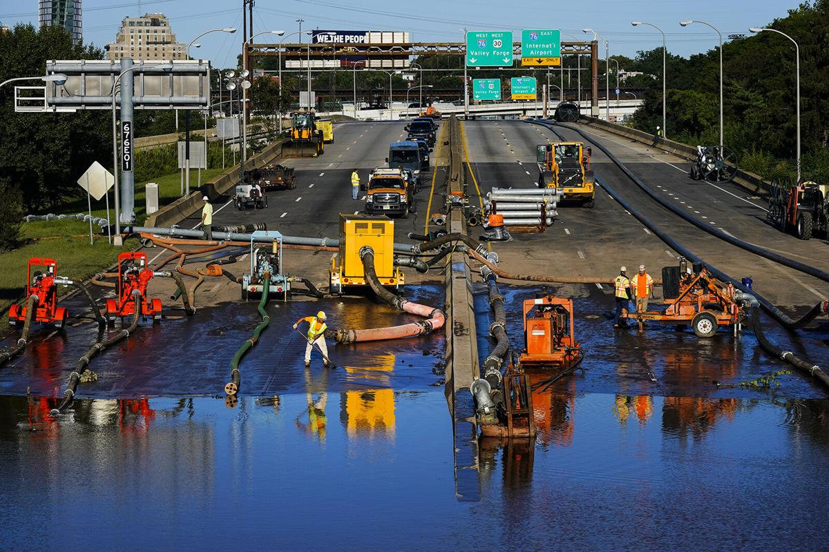
The catastrophic flooding was worse than almost anyone can imagine in Philadelphia and especially in and near New York City. The NWS Weather Prediction Center knew the combination of a stalled frontal boundary, which enhances upward motion, and unprecedented amounts of water vapor transported by now tropical rainstorm Ida made for the worst possible combination. Early on Wednesday, the NWS issued an almost unheard-of high risk for excessive rainfall and flash flooding at 3:20 a.m., many hours ahead of the multiple disasters.
The number of flash flood watches in advance of warnings issued by the NWS Philadelphia and New York City offices was the most I recall seeing. Infrared satellite imagery retrieved by National Center for Atmospheric Research scientist Dakota Smith tells some of the story.
Satellite imagery of storms that produced devastating flash floods in New Jersey & New York City.
A type of an event that is unequivocally worse with climate change. pic.twitter.com/3n43y3DSbA
— Dakota Smith (@weatherdak) September 2, 2021
Doctoral candidate Tomer Burg recovered NWS Doppler radar rainfall estimates through mid-Wednesday evening, when the event was still ongoing.
The NWS Central Park Observatory received 3.14 inches of rain in 60 minutes, smashing the old hourly record, which occurred just a week earlier during Henri’s passage, by more than an inch. Newark had its rainiest day in history as well, with more than 8 inches in a few hours. The NWS issued New York City’s first flash flood emergency in history, which is a step beyond a flash flood warning and points to the truly life-threatening nature of the flooding.
Ida’s total death toll is now up to at least 49, according to NBC News, with 45 of those deaths in the mid-Atlantic and Northeast. Here are the local storm reports compiled just by the NWS New York City office, not including reports from Philadelphia or Boston NWS offices.
There can be no doubt the warming climate holds some major responsibility for the degree of death and destruction, though quantifying its role with more precision will take additional time and research. But then there is the matter of infrastructure both in hurricane-prone coastal locations like barrier island Grand Isle, La., and in New York City and its suburbs. Civil engineering is well outside my field of knowledge. Yet, even I can see the vast New York City subway system serves as a natural drainage conduit by its very nature of construction, including more than 750 miles of underground tunnels, open drainage through grating and stairs, and proximity to overflowing storm drains. How can protection against these factors be better engineered? There may be ways, but I surely don’t know them.
Some subway stations in NYC now double as water parks!pic.twitter.com/ZXOhP7Tjtz
— Ben Noll (@BenNollWeather) September 2, 2021
While some of us tsk-tsk those who choose to live on vulnerable coasts, open to hurricane landfalls and flooding, there are many millions of Jerseyans, Pennsylvanians and New Englanders who live on flood plains near smaller creeks and rivers that frequently flood badly when such gigantic amounts of rain fall.
As climate models accurately predicted since the 1980s, arid regions would become more frequently and severely impacted by drought and wildfires, and wet regions would suffer more extreme rainfall events. All this has happened, and all this is worsening.
Since there is an already-certain inevitability to these drastic impacts, part of humanity’s efforts must be aimed toward more elaborate mitigation measures. Cities, even those not near the coast, are covered in hundreds of square miles of largely impermeable pavement and concrete, which leads to more fast-flowing flooding. Measures to be taken are going to be very costly, but the costs of not taking them would be far higher.